
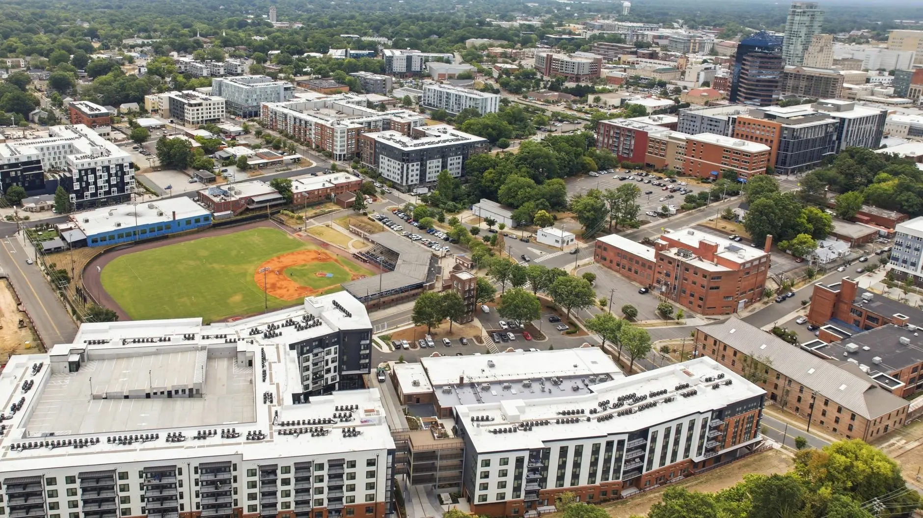
A notice about a new building on your street raises a fair question: what is urban planning, and who decides what gets built? It is the work of shaping land use, infrastructure and community development through rules, long-range plans and public decisions.
Quick answer: start with zoning if your question is about a specific lot, the comprehensive plan if it is about where the city is heading, and the participation section if a project is already proposed. The routes below sort the topic by what you want to do.
What urban planning means
Urban planning is the practice of deciding how land, streets, buildings and public spaces fit together in a city or town. Georgetown University’s School of Continuing Studies describes it as shaping the built environment in the service of improving the quality of life of local communities. The American Planning Association gives the goal in more concrete terms: to maximize the health, safety and economic well-being of residents.
That is the meaning of urban planning in plain terms, and it explains why the field touches so much of daily life. The University of Memphis planning department says city planning is concerned with the physical development of communities and with how that development interacts with social, economic and environmental well-being. Physical development covers what you can see from your front door: what stands on a lot, how wide the street is and where the park sits.
Why the purpose matters to neighbors
The purpose of urban planning is easiest to see at the edge of your own block. A vacant lot becomes something, and a set of public rules and decisions determines what. Planning supplies the shared framework, so that one owner’s wishes are weighed against the health, safety and economic well-being of everyone else.
The APA adds that urban planning shapes land use, infrastructure and community development. Those are the levers behind most visible change in a neighborhood, which is why the sections below take them in turn.
Who does the planning
National Geographic’s education resource describes urban planners as people who direct the development of cities and towns. The APA frames the job differently and more usefully for residents: a planner works with residents and elected officials to guide the layout of an entire community or region.
That wording matters. Planners do not act alone, and residents and elected officials are named partners in the work. It is also why this guide spends a full section on how to take part.
Routes through the topic
Planning vocabulary arrives all at once when a project is proposed nearby. These routes put the topics in the order most readers need them, depending on the situation.
- You want to know what is allowed on a lot. Read the zoning section next, then use our walkthrough on how to find zoning of a property to look up the parcel in question.
- You want to know where the city is heading. Go to the comprehensive plan section, then the sections on density and mixed-use places to see how those goals turn into streets and buildings.
- A project near you is already proposed. Skim the zoning and plan sections for the vocabulary, then go straight to the participation section.
- You are curious about transit, density or housing. The sections on density, mixed-use and transit-oriented places, and housing choices cover those themes together because they depend on each other.
- You are thinking about planning as a career. The closing section points to our guide on how to become an urban planner.
Zoning: the rules for each parcel
Zoning is the part of planning that most directly answers the question of what can be built on a given lot. The APA describes the zoning code as a set of rules that defines what each land parcel could or should be used for. Zoning shapes development by deciding which uses belong where.
The APA’s own example is simple: by zoning a street as residential, factories can be kept separate from housing. The University of Memphis planning department calls zoning regulations land use controls that guide development in the short term. Short-term here means the code governs the projects in front of the city now, while other tools set the longer view.
Reading zoning as a neighbor
Because the code works parcel by parcel, it is the most direct way to find out what could appear next door. The words “could or should” deserve a close reading. A use that a parcel could host under the code is not automatically one that the city’s long-range vision says it should host.
Our explainer on what is zoning covers the mechanics of districts and permitted uses. It is the better starting point if the vocabulary on a zoning map is new to you.
When a project does not fit the code
Proposals sometimes ask for something the code does not allow. That can mean a request for a case-specific departure from the rules or a request to change the rules for a parcel. Our guide on what is a zoning variance explains how these requests differ and what each one asks of the applicant.
For neighbors, these requests are natural moments to read the plan, compare it with the code and decide whether to comment. A project that fits the code as written raises a different question from one that asks the city to depart from it.
Comprehensive plans: the long-range blueprint
A comprehensive plan is the document that sets a community’s direction. The APA explains that a community plan, often called a comprehensive plan, is a kind of map or blueprint for the future. It considers what the community should offer residents 10, 15 or even 20 years into the future.
The University of Memphis notes that some land use planners work on long-range comprehensive plans, developing policies to help communities achieve a future vision. Our guide to what is a comprehensive plan goes further into how these documents are organized.
Zoning and the plan side by side
The two tools answer different questions, and confusing them is a common source of frustration at public meetings. The table shows how they compare.
| Tool | What it does | Time horizon | Planning use |
|---|---|---|---|
| Zoning code | Sets rules defining what each land parcel could or should be used for | Guides development in the short term | Check it first when the question is about a specific lot |
| Comprehensive plan | Acts as a map or blueprint of what the community should offer residents | Looks 10, 15 or even 20 years ahead | Use it to judge whether a proposal fits the stated direction |
These descriptions follow the American Planning Association and the University of Memphis planning department.
Using both together
Use the plan to ask where the city is trying to go, and the zoning code to ask what is allowed on this parcel today. When a proposal matches the code but cuts against the plan’s goals, or the reverse, that gap is usually the most useful thing to raise.
The plan is also the better place to look for context behind a project. Its goals tell you what the city says it wants, and a proposal can be read against that statement.
Land use, streets and public space
Land use planning is where these tools meet the ground. The University of Memphis describes land use planning as the most traditional venue for planning practice, and it also notes a great deal of overlap between transportation planning and land use planning. What gets built on a parcel and how people reach it are decided together.
The APA’s description of planning as shaping land use, infrastructure and community development points the same way. Streets, sidewalks and public spaces are not an afterthought to buildings. They are part of the same plan.

Street design
Street design is the part of planning most residents feel every day. How a roadway is divided among travel lanes, parking, crossings and bike space is a land use choice as much as a traffic one.

Wider roadways give vehicles more room but leave less for everything else. A narrower layout can make space for crossings and bike lanes. Neither choice is neutral, which is why street projects are worth following in the same way as building proposals.

Open space
Parks and plazas are planned in the same documents as housing and roads. When a plan names where open space belongs, it gives residents something concrete to point to when a nearby site is proposed for other uses. A comment that refers to the plan’s own language is easier for a board to weigh than a general objection.

Density, growth and sprawl
Urban density is a measure of how much activity and building a place holds, and it is one of the most debated subjects in planning. Part of the reason is scale. Georgetown’s School of Continuing Studies notes that cities will need to accommodate an additional 3 billion people within the next three decades. Where those residents live, and in what form, is a planning decision.

Growth is not uniform everywhere. National Geographic reports that the 2010 U.S. Census showed population growth slowed in 14 of the 15 largest urban centers. The practical lesson is that a plan has to rest on local trends rather than a single national story.
The lesson from spread-out development
National Geographic explains that, starting in the 1920s, increased dependency on cars led to more traffic and air pollution. It also notes that neighborhoods and shops were spread too far apart to visit in one trip. Low density, in that account, made ordinary errands harder.
Two of our guides pick up this thread. What is urban sprawl looks at the pattern of spread-out growth, and what is smart growth covers the planning approach that responds to it. Read them together if you are weighing a proposal for a higher-density building against one at the edge of town.
Mixed-use and transit-oriented places
Planners have responded to car dependence by putting daily needs closer together. These choices are the ones most likely to change the look of a neighborhood you already know.
How mixed-use development works
National Geographic describes mixed-use communities as places that enable residents to live, work and shop in the same area, which reduces reliance on the automobile. The mix it names is shops, housing and public transportation in the same neighborhood.
In practice, mixed-use development works by letting zoning allow more than one kind of use in an area, so that homes, stores and workplaces can sit near each other. The more your daily errands fit within the neighborhood, the less a car matters. Our guide on what is mixed use development explains the formats in more detail.
Transit-oriented development
Transit-oriented development builds on the overlap between transportation and land use that the University of Memphis points out. It places the mix of housing and shops around public transportation, so a station and the buildings near it are planned as one area.
If a station area near you is being rezoned or redeveloped, read the proposal as one package of transport and land use. Our guide on what is transit oriented development goes through how those packages are put together.
Housing choices and large projects
Planning is also how a community decides what kinds of homes get built. The APA says planning helps ensure that you have choices when it comes to what type of home you want to live in, and in how you get around. Those choices are the outcome of zoning rules, plan goals and the street network working together.

When housing is the center of a debate, the useful question is which options the code makes possible. A rule that allows only a single home type narrows the choices described above, while a code that permits more forms widens them. Our guide to what is inclusionary zoning covers one tool communities use to shape the housing that gets built.
Whole-project formats
Some developments are planned as a whole rather than lot by lot. Two formats you may meet on a notice are covered in our guides: what is a master planned community and what is a planned unit development. Read them if a proposal near you describes itself in either of those terms.
Taking part in a planning decision
Residents can take part because the planning process is built around engagement. Georgetown’s School of Continuing Studies says planners engage stakeholders, conduct thorough analyses and develop strategic plans. The APA describes the job as working with residents and elected officials.
The University of Memphis adds that neighborhood planners commonly work with citizen groups and community development corporations. It also notes that planners are called upon to present ideas to governing bodies, at civic meetings or before legislative commissions. Those venues are where residents can listen and respond.
A practical route for residents
Procedures vary by city, so the planning department’s own website is the authority on deadlines and formats. The steps below work in most places.
- Identify the rules that apply. Find the parcel’s zoning and the relevant section of the comprehensive plan, so you know what the proposal is measured against.
- Find where the decision will be heard. Look for the governing body, civic meeting or commission that will consider it, using the planning department’s notices.
- Join or contact a local group. A neighborhood or citizen group can pool concerns, and neighborhood planners commonly work with such groups.
- Frame your comment around the plan. A comment that refers to the plan’s stated goals or the code’s wording is easier for a board to act on than a general objection.
- Speak to elected officials as well. The APA names residents and elected officials as the planner’s partners, so both audiences matter.
Some public projects need private land, which is a separate legal question. Our guide on what is eminent domain explains how that works.
Where to go next
If you read a zoning code, two technical terms come up quickly. Our guides explain what is a setback in zoning and what is floor area ratio, and both help translate a code into what a building will look like.
Anyone drawn to the work itself can read about how to become an urban planner. For everyone else, the most useful next step is the plan and zoning for your own neighborhood, read before a project appears rather than after.
Frequently asked questions
| Question | Answer |
|---|---|
| What does an urban planner actually produce? | Georgetown’s School of Continuing Studies says planners create the rules, codes and frameworks by which buildings, roads and public spaces are regulated, working with architects and engineers. |
| Why do planning decisions matter for so long? | Urban investment decisions have long-lasting implications, typically measured in decades, so a choice made today shapes the neighborhood for years. |
| When did zoning begin? | National Geographic explains that city governments created laws called zoning ordinances in the late 19th century to keep people, business and industry separate. |
| Is land use planning the same as city planning? | Not exactly. The University of Memphis calls land use planning the most traditional venue for planning practice, so it is a core part of the wider field of city planning. |